This Map Shows Your Flood Risk Is Probably Worse Than You Think
The federal numbers are vastly different, which is a big problem.

There’s no doubt about it: the effects of climate change are already here. With frequent floods, higher temperatures, and more extreme weather events, climate change has the very real potential to drastically change our lives. And this map, which shows the flood risk where you live, is strengthening the case that we need to make changes now.
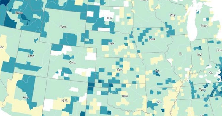
According to The New York Times, the flood risk across much of the United States is far greater than most people realize and greater than the estimates from government bodies. According to more recent calculations, millions of people are exposed to hidden flood risks. And it’s going to continue to get worse as the climate continues to change and get wetter and warmer.
The publication reports the new calculation takes into account data points like rainfall and flooding in smaller creeks that haven’t been mapped yet federally and predicted sea-level rise. The new calculation estimates that 14.6 million properties are in potential danger of a 100-year flood, which is what experts call a massive flood that has a 1 percent chance of hitting in any year. This number is massively different than the 8.7 million properties at risk according to the federal government flood risk maps, nearly double.
“Millions of home and property owners have had no way of knowing the significant risk they face,” Matthew Eby, founder and executive director of the First Street Foundation, said. Eby compiled the data and created a website where people can check their own addresses flood risk.
The New York Times explains that with the hidden flood risks, builders and homeowners haven’t been given accurate data on their own risks. The flood maps distributed by the federal government helps builders and homebuyers estimate the flood risk which impacts how much risk mortgage lenders take on, if someone should purchase flood insurance, and acts as a guide on where and how new buildings are developed.
“If the new estimates are broadly accurate, it would mean that homeowners, builders, banks, insurers, and government officials nationwide have been making decisions with information that understates their true physical and financial risks,” The New York Times reports.
Looking into the data, people in Chicago have a far larger risk of floods than the federal map shows. 75,000 additional properties in the city have a previously undisclosed flood risk, and similar hidden risks are found in Florida, New York, and Tennessee, for example.
You can check out the interactive map on The New York Times listed by county or check out First Street Foundation to look up your address.
This article was originally published on